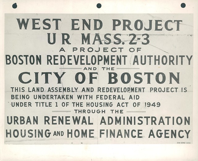
"The West End is a small neighborhood located north of Beacon Hill. Considerably altered by Urban Renewal policies of the 1950s, the West End was once a dense and diverse ethnic neighborhood, and now features large apartment towers set in landscaping and pathways." (Boston Planning & Development Agency)
"The history of the West End is one of continual change, American firsts, Boston innovations, and modern icons. The West End Museum celebrates the story of the neighborhood that led the way in Boston’s immigrant era, supporting thousands of the world’s “huddled masses” as they found their way from North End slums to the American Dream. By then, the West End had already produced America’s first native-born architect, provided a home for free Black citizens after the Revolution, and led the way in the construction of railroads, electric street cars, and so much more. The neighborhood changed dramatically after 1950. Two decades of Urban Renewal led to the clearing of more than half the neighborhood, and reinvention in its modern form." (The West End Museum)
Click the left and right arrows to see how the West End's landscape has changed over time.

1955 - Metro Boston Aerial view captured by USGS
Although the Urban Renewal project was announced in 1953, demolition of West End neighborhoods did not begin until 1958. See how densely the neighborhoods are packed.

1965 - Boston Downtown BPDA Aerials
See how entire neighborhoods were demolished during the Urban Renewal projects of the late 1950s.
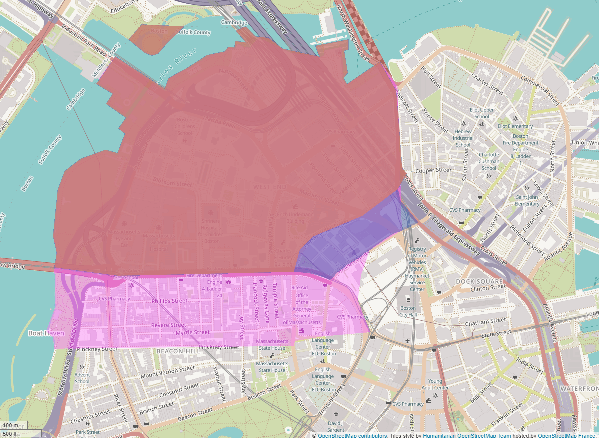
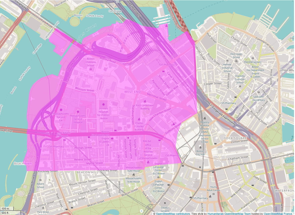
"The Modern West End Neighborhood as defined by the Boston Planning and Development Agency and political districts (red) and by the West End Civic Association (blue) overlain on the Historic West End (pink)."
320 Newbury Street
6th Floor
Boston, MA 02115
T: 617.585.0155
E: library@the-bac.edu
320 Newbury Street
5th Floor, RM 511
Boston, MA 02115
T: 617.585.0257
E: vrlib@the-bac.edu
951 Boylston Street
RM G6
Boston, MA 02115
T: 617.585.0133